Wide Worlds Snapshots

We help you to see the Whole World in Snapshots, And you follow us in your likes and comments/.

Wide Worlds Snapshots

We help you to see the Whole World in Snapshots, And you follow us in your likes and comments/.

Wide Worlds Snapshots

We help you to see the Whole World in Snapshots, And you follow us in your likes and comments/.

Wide Worlds Snapshots

We help you to see the Whole World in Snapshots, And you follow us in your likes and comments/.

Wide Worlds Snapshots

We help you to see the Whole World in Snapshots, And you follow us in your likes and comments/.

Monday, 24 November 2014

Qatar - The Wide Worlds Snaps

Emir: Sheikh Tamim ibn Hamad Al Thani (2013)
Prime Minister: Sheikh Abdullah ibn Nasser ibn Khalifah Al Thani (2013)
Total area: 4,416 sq mi (11,437 sq km)
Population (2014 est.): 2,123,160 (growth rate: 3.58%); birth rate: 9.95/1000; infant mortality rate: 6.42/1000; life expectancy: 78.38; density per sq mi: 455
Capital (2011 est.): Doha, 567,000
Monetary unit: Qatari riyal

Qatar was once controlled by the sheikhs of Bahrain, but in 1867, war broke out between the people and their absentee rulers. To keep the peace in the Persian Gulf, the British installed Muhammad ibn Thani al-Thani, head of a leading Qatari family, as the region's ruler. In 1893, the Ottoman Turks made incursions into Qatar, but the emir successfully deflected them. In 1916, the emir agreed to allow Qatar to become a British protectorate.
Oil was discovered in the 1940s, bringing wealth to the country in the 1950s and 1960s. About 85% of Qatar's income from exports comes from oil. Its people have one of the highest per capita incomes in the world. In 1971, Qatar was to join the other emirates of the Trucial Coast to become part of the United Arab Emirates. But both Qatar and Bahrain decided against the merger and instead formed independent nations.
Qatar permitted the international forces to use Qatar as a base during the 1991 Persian Gulf War. A border dispute erupted with Saudi Arabia that was settled in Dec. 1992. A territorial dispute with Bahrain over the Hawar Islands remains unresolved, however. In 1994, Qatar signed a defense pact with the U.S., becoming the third Gulf state to do so.
In June 1995, Crown Prince Hamad bin Khalifa al-Thani deposed his father, primarily because the king was out of step with the country's economic reforms. The emir was not stripped of his title, and much of the power was already in his son's hands. The new emir lifted press censorship and instituted other liberal reforms, including democratic elections and women's suffrage (1999). In 2003 Crown Prince Jassim, who declared he had never wanted to be king, abdicated in favor of his younger brother, Prince Tamim.
Qatar is the home of Al Jazeera, the immensely popular and controversial Arabic satellite television network.
Qatar introduced its first constitution on June 9, 2005. It guarantees freedom of expression, assembly, and religion and calls for a 45-seat parliament. Thirty of the seats will be filled in democratic elections; the emir will appoint the remaining seats.
Sheik Abdullah bin Khalifa Al Thani resigned as prime minister in April 2007. The emir named former foreign minister Sheik Hamad bin Jassem al Thani as his replacement.
On June 25, 2013, Emir Sheikh Hamad ibn Khalifah Al Thani abdicated the throne. His fourth son, Sheikh Tamim bin Hamad bin Khalifa Al Thani, age 33, succeeded him as emir. Sheikh Tamim bin Hamad bin Khalifa Al Thani appointed his cabinet, including Sheikh Abdullah ibn Nasser ibn Khalifah Al Thani as the new prime minster.


http://wideworldsnaps.tk/

Tags: the wide world snaps, whole world pictures, Qatar beautifull pictures, Qatar cities, Qatar snaps,Qatar - The Wide Worlds Snaps,The Wide Worlds Snaps,

Oman - The Wide Worlds Snaps

Sultan: Qabus ibn Sa'id (1970)
Total area: 82,031 sq mi (212,460 sq km)
Population (2010 est.): 2,967,717 (growth rate: 1.9%); birth rate: 23.9/1000; infant mortality rate: 16.8/1000; life expectancy: 74.1; density per sq mi: 15
Capital (2003 est.): Muscat, 797,000 (metro. area), 54,800 (city proper)
Monetary unit: Omani rial
Arabs migrated to Oman from the 9th century BC onward, and conversion to Islam occurred in the 7th century AD Muscat, the capital of the geographical area known as Oman, was occupied by the Portuguese from 1508 to 1648. Then it fell to Ottoman Turks, but in 1741, Ahmad ibn Sa'id forced them out, and the descendants of Sultan Ahmad rule Oman today.
Ahmad expanded his empire to East Africa, and for a time the Omani capital was in Zanzibar. After 1861, however, Zanzibar fell from Omani control.
The sultans and imams of Oman clashed continuously throughout the 20th century until 1959, when the last Ibadi imam was evicted from the country. In a palace coup on July 23, 1970, the sultan, Sa'id bin Taimur, who had ruled since 1932, was overthrown by his son, Qabus ibn Sa'id, who promised to establish a modern government and use newfound oil wealth to aid the people of this very isolated state. Oman joined the Arab League and the United Nations in 1971.
A long border dispute with Yemen was resolved in Oct. 1992; in 1997, the countries agreed to new maps defining the border.
In 1997, Sultan Qabus granted women the right to be elected to the country's consultative body, the Shura Council (Majlis al-Shura). In 2003, the sultan extended voting rights to everyone over 21; previously, voters were selected from among the elite, and only about a quarter of the population was allowed to vote.


Tags: Oman Cities,Oman country,Oman cities pics, Oman pics, whole world pictures,Oman - The Wide Worlds Snaps,The Wide Worlds Snaps,

Sunday, 23 November 2014

Kuwait - The Wide Worlds Snaps

Emir: Sheik Sabah al-Ahmad al-Jabir al-Sabah (2006)
Prime Minister: Sheikh Jabir al-Mubarak al-Hamad al-Sabah (2011)
Total area: 6,880 sq mi (17,819 sq km)
Population (2014 est.): 2,742,711 (growth rate: 1.7%); birth rate: 20.26/1000; infant mortality rate: 7.51/1000; life expectancy: 77.64
Capital (2011 est.): Kuwait, 2.406 million
Monetary unit: Kuwaiti dinar (KD)
National name: Dawlat al-Kuwayt
Current government officials
Languages: Arabic (official), English
Ethnicity/race: Kuwaiti 31.3%, other Arab 27.9%, Asian 37.8%, African 1.9%, other 1.1% (includes European, North American, South American, and Australian) (2013 est.)
Religions: Muslim (official) 76.7%, Christian 17.3%, other and unspecified 5.9%
note: represents the total population; about 69% of the population consists of immigrants (2013 est.)
National Holiday: National Day, February 25
Literacy rate: 93.9% (2008)
Economic summary:
GDP/PPP (2013 est.): $165.8 billion; per capita $42,100.
Real growth rate: 2.3%.
Inflation: 2.8%.
Unemployment: 3.4% (2011 est.).
Arable land: 0.62%.
Agriculture: practically no crops; fish.
Labor force: 2.38 million;
note: non-Kuwaitis represent about 60% of the labor force; agriculture n.a., industry n.a., services n.a.
Industries: petroleum, petrochemicals, cement, shipbuilding and repair, desalination, food processing, construction materials.
Natural resources: petroleum, fish, shrimp, natural gas.
Exports: $112 billion (2013 est.): oil and refined products, fertilizers.
Imports: $22.42 (2013 est.): food, construction materials, vehicles and parts, clothing.
Major trading partners: Japan, India, South Korea, U.S., Germany, UAE, Saudi Arabia, China, Singapore (2011).
Communications: Telephones: main lines in use: 510,000 (2012); mobile cellular: 5.526 million (2012).
Broadcast media: state-owned TV broadcaster operates 4 networks and a satellite channel; several private TV broadcasters have emerged since 2003; satellite TV is available with pan-Arab TV stations especially popular; state-owned Radio Kuwait broadcasts on a number of channels in Arabic and English; first private radio station emerged in 2005; transmissions of at least 2 international radio broadcasters are available (2007).
Internet Service Providers (ISPs): 2,771 (2012).
Internet users: 1.1 million (2009).
Transportation: Railways: 0 km.
Highways: total: 6,608 km (2010).
Waterways: none.
Ports and harbors: Ash Shu'aybah, Ash Shuwaykh, Az Zawr (Mina' Sa'ud), Mina' 'Abd Allah, Mina' al Ahmadi.
Airports: 7 (2013).
International disputes: Kuwait and Saudi Arabia continue negotiating a joint maritime boundary with Iran; no maritime boundary exists with Iraq in the Persian Gulf.

Kuwait is believed to have been part of an early civilization in the 3rd millennium B.C. and to have traded with Mesopotamian cities. Archeological and historical traces disappeared around the first millennium B.C. At the beginning of the 18th century, the 'Anizah tribe of central Arabia founded Kuwait City, which became an autonomous sheikdom by 1756. 'Abd Rahim of the al-Sabah became the first sheik, and his descendants continue to rule Kuwait today. In the late 18th and early 19th centuries, the sheikdom belonged to the fringes of the Ottoman Empire. Kuwait obtained British protection in 1897 when the sheik feared that the Turks would expand their hold over the area. In 1961, Britain ended the protectorate, giving Kuwait independence, but agreed to give military aid on request. Iraq immediately threatened to occupy the area, and the British sent troops to defend Kuwait. Soon afterward, the Arab League sent in troops, replacing the British. Iraq's claim was dropped when the Arab League recognized Kuwait's independence on July 20, 1961. Historically, Kuwait followed a neutral and mediatory policy among Arab states.


http://wideworldsnaps.tk/

Taags: Kuwait country,Kuwait cities,Kuwait cities pics,Kuwait pics,Kuwait - The Wide Worlds Snaps,The Wide Worlds Snaps,

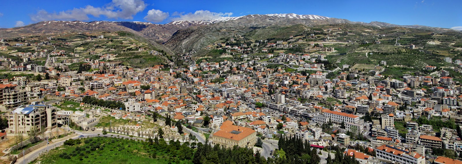
Lebanon - The Wide Worlds Snaps

President: Tammam Salam (acting) (2014)
Prime Minister: Tammam Salam (2014)
Land area: 3,950 sq mi (10,230 sq km);
total area: 4,015 sq mi (10,400 sq km)
Population (2014 est.): 5,882,562 (growth rate: 9.37%); birth rate: 14.8/1000; infant mortality rate: 7.98/1000; life expectancy: 77.22
Capital and largest city (2011 est.): Beirut, 2.022 million
Monetary unit: Lebanese poundAfter World War I, France was given a League of Nations mandate over Lebanon and its neighbor Syria, which together had previously been a single political unit in the Ottoman Empire. France divided them in 1920 into separate colonial administrations, drawing a border that separated mostly Muslim Syria from the kaleidoscope of religious communities in Lebanon, where Maronite Christians were then dominant. After 20 years of the French mandate regime, Lebanon's independence was proclaimed on Nov. 26, 1941, but full independence came in stages. Under an agreement between representatives of Lebanon and the French National Committee of Liberation, most of the powers exercised by France were transferred to the Lebanese government on Jan. 1, 1944. The evacuation of French troops was completed in 1946.
According to the unwritten National Pact, different religious communities were represented in the government by a Maronite Christian president, a Sunni Muslim prime minister, and a Shiite national assembly speaker. This arrangement worked for two decades.Civil war broke out in 1958, with Muslim factions led by Kamal Jumblat and Saeb Salam rising in insurrection against the Lebanese government headed by President Camille Chamoun, a Maronite Christian favoring close ties to the West. At Chamoun's request, President Eisenhower, on July 15, sent U.S. troops to reestablish the government's authority.


http://wideworldsnaps.tk/


Tags: The Wide Worlds Snaps, whole world pictures, beautifull countries, Lebanon country pics, Lebanon beautifull pics,

Jordan - The Wide Worlds Snaps

Ruler: King Abdullah II (1999)
Prime Minister: Abdullah Ensour (2012)
Land area: 34,286 sq mi (88,802 sq km);

total area: 34,495 sq mi (89,342 sq km) excludes West Bank
Population (2014 est.): 7,930,491 (growth rate: 3.86%); birth rate: 25.23/1000; infant mortality rate: 15.73/1000; life expectancy: 74.1
Capital and largest city (2011 est.): Amman, 1.179 million
Monetary unit: Jordanian dinar
National name: Al-Mamlaka al-Urduniya al-Hashimiyah
Current government officials
Languages: Arabic (official), English
Ethnicity/race: Arab 98%, Circassian 1%, Armenian 1%
Religions: Muslim 97.2% (official; predominantly Sunni), Christian 2.2% (majority Greek Orthodox, but some Greek and Roman Catholics, Syrian Orthodox, Coptic Orthodox, Armenian Orthodox, and Protestant denominations), Buddhist 0.4%, Hindu 0.1%, Jewish
National Holiday: Independence Day, May 25
Literacy rate: 95.9% (2011 est.)
Economic summary:
GDP/PPP (2013 est.): $40.02 billion; per capita $6,100.
Real growth rate: 3.3%.
Inflation: 5.9%.
Unemployment: 14% official rate; unofficial rate is approximately 30% (2011 est.).
Arable land: 1.97%.
Agriculture: citrus, tomatoes, cucumbers, olives, strawberries, stone fruits; sheep, poultry, dairy.
Labor force: 1.818 million; services 77.4%, industry 20%, agriculture 2.7% (2007 est.).
Industries: clothing, fertilizers, potash, phosphate mining, pharmaceuticals, petroleum refining, cement, inorganic chemicals, light manufacturing, tourism.
Natural resources: phosphates, potash, shale oil.
Exports: $7.914 billion (2013 est.): clothing, phosphates, fertilizers, potash, vegetables, pharmaceuticals.
Imports: $18.61 billion (2013 est.): crude oil, machinery, transport equipment, iron, cereals.
Major trading partners: U.S., Iraq, India, Saudi Arabia, China, Italy, Turkey, Indonesia (2012).
Communications:
Telephones: main lines in use: 435,000 (2012); mobile cellular: 8.984 million (2012).
Broadcast media: radio and TV dominated by the government-owned Jordan Radio and Television Corporation (JRTV) that operates a main network, a sports network, a film network, and a satellite channel; first independent TV broadcaster aired in 2007; international satellite TV and Israeli and Syrian TV broadcasts are available; roughly 30 radio stations with JRTV operating the main government-owned station; transmissions of multiple international radio broadcasters are available (2007).

Internet hosts: 69,473 (2012).
Internet users: 1.642 (2009).
Transportation: Railways: total: 507 km (2011).
Highways: total: 7,203 km; paved: 7,203 km; unpaved: 0 km (2011).
Ports and terminals: Al 'Aqabah.
Airports: 18 (2013).
International disputes: 2004 Agreement settles border dispute with Syria pending demarcation.In biblical times, the country that is now Jordan contained the lands of Edom, Moab, Ammon, and Bashan. Together with other Middle Eastern territories, Jordan passed in turn to the Assyrians, the Babylonians, the Persians, and, about 330 B.C. , the Seleucids. Conflict between the Seleucids and the Ptolemies enabled the Arabic-speaking Nabataeans to create a kingdom in southeast Jordan. In A.D. 106 it became part of the Roman province of Arabia and in 633–636 was conquered by the Arabs. In the 16th century, Jordan submitted to Ottoman Turkish rule and was administered from Damascus. Taken from the Turks by the British in World War I, Jordan (formerly known as Transjordan) was separated from the Palestine mandate in 1920, and in 1921, placed under the rule of Abdullah ibn Hussein.In 1923, Britain recognized Jordan's independence, subject to the mandate. In 1946, grateful for Jordan's loyalty in World War II, Britain abolished the mandate. That part of Palestine occupied by Jordanian troops was formally incorporated by action of the Jordanian parliament in 1950. King Abdullah was assassinated in 1951. His son Talal, who was mentally ill, was deposed the next year. Talal's son Hussein, born on Nov. 14, 1935, succeeded him.


Tags: The Wide Worlds Snaps, Jordan, Jordan - The Wide Worlds Snaps, Jordan beautifull country, Jordan pictures, Jordan cities, Jordan snaps,