Wide Worlds Snapshots

We help you to see the Whole World in Snapshots, And you follow us in your likes and comments/.

Wide Worlds Snapshots

We help you to see the Whole World in Snapshots, And you follow us in your likes and comments/.

Wide Worlds Snapshots

We help you to see the Whole World in Snapshots, And you follow us in your likes and comments/.

Wide Worlds Snapshots

We help you to see the Whole World in Snapshots, And you follow us in your likes and comments/.

Wide Worlds Snapshots

We help you to see the Whole World in Snapshots, And you follow us in your likes and comments/.

Saturday, 6 December 2014

Portugal - The Wide Worlds Snaps

Portuguese Republic
President: AnĂ­bal Cavaco Silva (2006)
Prime Minister: Pedro Passos Coelho (2011)
Land area: 35,382 sq mi (91,639 sq km);
total area: 35,672 sq mi (92,391 sq km)
Population (2014 est.): 10,813,834 (growth rate: 0.12%); birth rate: 9.42/1000; infant mortality rate: 4.48/1000; life expectancy: 79.01
Capital and largest city (2011 est.) Lisbon, 2.843 million
Other large city: Porto, 1.367 million (2011)
Monetary unit: Euro (formerly escudo)

An early Celtic tribe, the Lusitanians, are believed to have been the first inhabitants of Portugal. The Roman Empire conquered the region in about 140 BC Toward the end of the Roman Empire, the Visigoths had invaded the entire Iberian Peninsula.

Portugal won its independence from Moorish Spain in 1143. King John I (1385–1433) unified his country at the expense of the Castilians and the Moors of Morocco. The expansion of Portugal was brilliantly coordinated by John's son, Prince Henry the Navigator. In 1488, Bartolomeu Dias reached the Cape of Good Hope, proving that Asia was accessible by sea. In 1498, Vasco da Gama reached the west coast of India. By the middle of the 16th century, the Portuguese empire extended to West and East Africa, Brazil, Persia, Indochina, and the Malayan peninsula.

In 1581, Philip II of Spain invaded Portugal and held it for 60 years, precipitating a catastrophic decline in Portuguese commerce. Courageous and shrewd explorers, the Portuguese proved to be inefficient and corrupt colonizers. By the time the Portuguese monarchy was restored in 1640, Dutch, English, and French competitors had begun to seize the lion's share of the world's colonies and commerce. Portugal retained Angola and Mozambique in Africa, and Brazil (until 1822).


Tags: the wide world snaps, whole world pictures, Portugal beautifull pictures, Portugal pics, Portugal cities, Portugal country,whole world pics,beautifull countries,

Montenegro - The Wide Worlds Snaps

President: Filip Vujanovic (2003)
Prime Minister: Milo Djukanovic (2012)
Land area: 5,333 sq mi (13,812 sq km);
total area: 5,415 sq mi (14,026 sq km)
Population (2012 est.): 657,394 (growth rate: –0.633%); birth rate: 10.89/1000; death rate: 9.03/1000.
Capital (2009 est.): Podgorica, 144,000
Monetary unit: Euro
National name: Republike Crne Gore
Current government officials
Languages: Serbian 63.6%, Montenegrin (official) 22%, Bosnian 5.5%, Albanian 5.3%, unspecified (includes Croatian) 3.7% (2003 census)
Ethnicity/race: Montenegrin 43%, Serbian 32%, Bosniak 8%, Albanian 5%, other (Muslims, Croats, Roma) 12%
Religions: Orthodox 74.2%, Muslim 17.7%, Catholic 3.5%, other 0.6%, unspecified 3%, atheist 1% (2003 census)
National Holiday: National Day, July 13
Literacy rate: 98.4% (2010 est.)
Economic summary: GDP/PPP (2009 est.): $7.288 billion; per capita $11,700.
Real growth rate: .2%.
Inflation: 3%.
Unemployment: 11.5%.
Arable land: 13.7%.
Agriculture: tobacco, potatoes, citrus fruits, olives, grapes; sheep.
Labor force: 251,300; agriculture 6.3%, industry 20.9%, services 72.8% (2011).
Industries: steelmaking, agricultural processing, consumer goods, tourism.
Natural resources: bauxite, hydroelectricity.
Exports: $640 million (2011).
Imports: $2.4 billion (2011).
Major trading partners: Serbia, Croatia, Bosnia and Herzegovina, Greece, Hungary.
Communications: Telephones: main lines in use: 169,500 (2010); mobile cellular: 1.17 million (2010). Broadcast media: state-funded national radio-TV broadcaster operates 2 terrestrial TV networks, 1 satellite TV channel, and 2 radio networks; 4 public TV stations and some 20 private TV stations; 14 local public radio stations and more than 40 private radio stations (2007). Internet hosts: 10,088 (2012). Internet users: 280,000 (2009).
Transportation: Railways: total: 250 km (2007).
Highways: total: 7,624 km; paved: 5,097 km unpaved: 2,527 km (2008).
Ports and terminals: Bar.
Airports: 5 (2012).
International disputes: none.


The first inhabitants on the Balkan peninsula were the ancient people known as the Illyrians. The Slavic people followed in the 6th and 7th centuries. What is now Montenegro was the Serbian principality of Zeta in the 14th century. The principality was under the rule of the Ottoman Empire from the 14th to the 19th century, though this mountainous region managed to evade tight Ottoman control. It then became a principality within the Austro-Hungarian Empire, and in 1878 achieved independence. In 1910, Prince Nicholas I proclaimed himself king. During World War I, Montenegro fought on the side of the Allies and was defeated by Austro-German forces.


Nicholas was forced to flee the country and Montenegro was annexed to Serbia, then called the Kingdom of the Serbs, Croats, and Slovenes, and renamed Yugoslavia in 1929. After World War II, Yugoslavia became a Communist republic under Josip Tito. Tito's tight rein kept ethnic tensions in check until his death in 1980. Without his pan-Slavic influence, ethnic and nationalist differences began to flare, and by the 1990s Yugoslavia started to disintegrate in a brutal ten-year civil war.

In the war's aftermath, Serbia and Montenegro were the only two remaining republics of Yugoslavia, and in Feb. 2003, they formed a new state, a loose federation called Serbia and Montenegro. The arrangement was made to placate Montenegro's restive stirrings for independence and stipulated that Montenegro could hold a referendum on independence after three years. In May 2003, Filip Vujanovic, a strong advocate of Montenegrin independence, was elected Montenegro's president.


Tags: the wide world snaps, whole world pictures, Montenegro beautifull pictures, Montenegro pictures, Montenegro snaps, Montenegro cities,

Malta - The Wide Worlds Snaps

President: Marie-Louise Coleiro Preca (2014)
Prime Minister: Joseph Muscat (2013)
Total area: 124 sq mi (321 sq km)
Population (2014 est.): 412,655 (growth rate: 0.33%); birth rate: 10.24/1000; infant mortality rate: 3.59/1000; life expectancy: 80.11
Capital (2011 est.): Valletta, 198,000

Monetary unit: EuroThe strategic importance of Malta was recognized by the Phoenicians, who occupied it, as did, in turn, the Greeks, Carthaginians, and Romans. The apostle Paul was shipwrecked there in A.D. 60. With the division of the Roman Empire in A.D. 395, Malta was assigned to the eastern portion dominated by Constantinople. Between 870 and 1090, it came under Arab rule. In 1091, the Norman noble Roger I, then ruler of Sicily, came to Malta with a small retinue and defeated the Arabs. The Knights of St. John (Malta), who obtained the three habitable Maltese islands of Malta, Gozo, and Comino from Charles V in 1530, reached their highest fame when they withstood an attack by superior Turkish forces in 1565. Napoléon seized Malta in 1798, but the French forces were ousted by British troops the next year, and British rule was confirmed by the Treaty of Paris in 1814.


Tags: the wide world snaps, whole world pictures, whole countries, Malta cities, Malta beautifull pictures, Malta snaps,

Friday, 5 December 2014

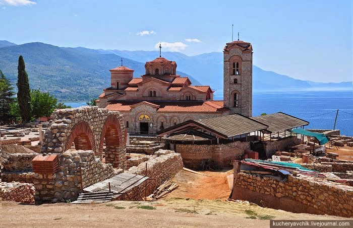
Macedonia - The Wide Worlds Snaps

President: Gjorge Ivanov (2009)
Prime Minister: Nikola Gruevski (2006) Land area: 9,928 sq mi (25,173 sq km);
total area: 9,781 sq mi (25,333 sq km)
Population (2014 est.): 2,091,719 (growth rate: 0.21%); birth rate: 11.64/1000; infant mortality rate: 7.9/1000; life expectancy: 75.8
Capital and largest city (2011 est.): Skopje, 499,000
Monetary unit: Denar
National Name: Republika Makedonija
Current government officialsLanguages: Macedonian (official) 66.5%, Albanian (official) 25.1%, Turkish 3.5%, Roma 1.9%, Serbian 1.2%, other 1.8% (2002 census)
Ethnicity/race: Macedonian 64.2%, Albanian 25.2%, Turkish 3.9%, Roma (Gypsy) 2.7%, Serb 1.8%, other 2.2% (2002 census)
Religions: Macedonian Orthodox 64.7%, Muslim 33.3%, other Christian 0.37%, other and unspecified 1.63% (2002 census)
National Holiday: Ilinden Uprising Day, August 2
Literacy rate: 97.4% (2010 est.)
Economic summary: GDP/PPP (2013 est.): $22.57 billion; per capita $10,800.
Real growth rate: 3.1%.
Inflation: 3.3%.
Unemployment: 28.6%.
Arable land: 16.1%.

Agriculture: grapes, wine, tobacco, vegetables; milk, eggs.
Labor force: 960,700 (2013 est.); agriculture 18.8%, industry 27.5%., services 53.7%.
Industries: food processing, beverages, textiles, chemicals, steel, cement, energy, pharmaceuticals. Natural resources: low-grade iron ore, copper, lead, zinc, chromite, manganese, nickel, tungsten, gold, silver, asbestos, gypsum, timber, arable land.
Exports: $4.267 billion (2013 est.): food, beverages, tobacco; miscellaneous manufactures, iron and steel; automotive parts.
Imports: $6.6 billion (2013 est.): machinery and equipment, automobiles, chemicals, fuels, food products. Major trading partners: Germany, Italy, Greece, Bulgaria, Italy, Turkey, U.K., Serbia, China, Kosovo (2011).
Communications: Telephones: main lines in use: 407,900 (2012); mobile cellular: 2.235 million (2012).

Broadcast media: public TV broadcaster operates 3 national channels and a satellite network; 5 privately-owned TV channels broadcast nationally using terrestrial transmitters and about 15 broadcast on national level via satellite; roughly 75 local commercial TV stations; large number of cable operators offering domestic and international programming; public radio broadcaster operates over multiple stations; 3 privately-owned radio stations broadcast nationally; about 70 local commercial radio stations (2012).

Internet Service Providers (ISPs): 62,826 (2012).
Internet users: 1.057 million (2009).
Transportation: Railways: total: 699 km (2002).
Roadways: total: 14,038 km (including 259 km of expressways); (2012 est.).
Waterways: none, lake transport only.
Ports and terminals: none.
Airports: 10 (2013).

International disputes: Kosovo and Macedonia completed demarcation of their boundary in September 2008; Greece continues to reject the use of the name Macedonia or Republic of Macedonia.The Republic of Macedonia occupies the western half of the ancient Kingdom of Macedonia. Historic Macedonia was defeated by Rome and became a Roman province in 148 B.C. After the Roman Empire was divided in A.D. 395, Macedonia was intermittently ruled by the Byzantine Empire until Turkey took possession of the land in 1371. The Ottoman Turks dominated Macedonia for the next five centuries, until 1913. During the 19th and 20th centuries, there was a constant struggle by the Balkan powers to possess Macedonia for its economic wealth and its strategic military corridors. The Treaty of San Stefano in 1878, ending the Russo-Turkish War, gave the largest part of Macedonia to Bulgaria. Bulgaria lost much of its Macedonian territory when it was defeated by the Greeks and Serbs in the Second Balkan War of 1913. Most of Macedonia went to Serbia and the remainder was divided among Greece and Bulgaria.


Tags: the wide world snaps, whole world snaps, Macedonia beautifull country, Macedonia cities, Macedonia pics,

Italy - The Wide Worlds Snaps

President: Giorgio Napolitano (2006)
Prime Minister: Matteo Renzi (2014)
Land area: 113,521 sq mi (294,019 sq km);
total area: 116,305 sq mi (301,230 sq km)
Population (2014 est.): 61,680,122 (growth rate: 0.3%); birth rate: 8.84/1000; infant mortality rate: 3.31/1000; life expectancy: 82.03
Capital and largest city (2011 est.): Rome, 3.298 million
Other large cities: Milan 2.909 million; Naples 2.373 million; Turin 1.613 million; Palermo 915,000; Bergamo 784,000 (2011)
Monetary unit: Euro (formerly lira)


The migrations of Indo-European peoples into Italy probably began about 2000 B.C. and continued until 1000 B.C. From about the 9th century B.C. until it was overthrown by the Romans in the 3rd century B.C. , the Etruscan civilization was dominant. By 264 B.C. , all Italy south of Cisalpine Gaul was under the leadership of Rome.


For the next seven centuries, until the barbarian invasions destroyed the western Roman Empire in the 4th and 5th centuries A.D. , the history of Italy is largely the history of Rome. From 800 on, the Holy Roman Emperors, Roman Catholic popes, Normans, and Saracens all vied for control over various segments of the Italian peninsula.

Numerous city-states, such as Venice and Genoa, whose political and commercial rivalries were intense, and many small principalities flourished in the late Middle Ages. Although Italy remained politically fragmented for centuries, it became the cultural center of the Western world from the 13th to the 16th century.


Tags: the wide world snaps, whole world pictures, Italy beautifull pictures, Italy beautifull snaps, Italy cities,Italy - The Wide Worlds Snaps,The Wide Worlds Snaps,